
McDonald County Interactive Map
The county’s interactive mapping application provides a simple feature set for searching and displaying the county’s GIS (Geographic Information System) data. Our web mapping portal is powered by HyperGIS, an innovative online mapping interface designed for rapid user response. We think you’ll like the wide view, no-nonsense layout. Give it a spin.
McDonald County Maps
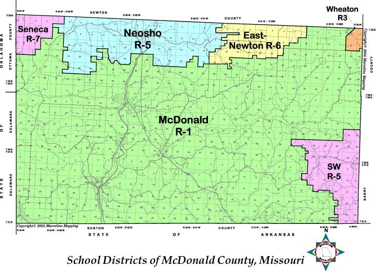
SchoolDistricts
Low-Resolution JPEG ( 74k)
High-Resolution.PDF (842k)
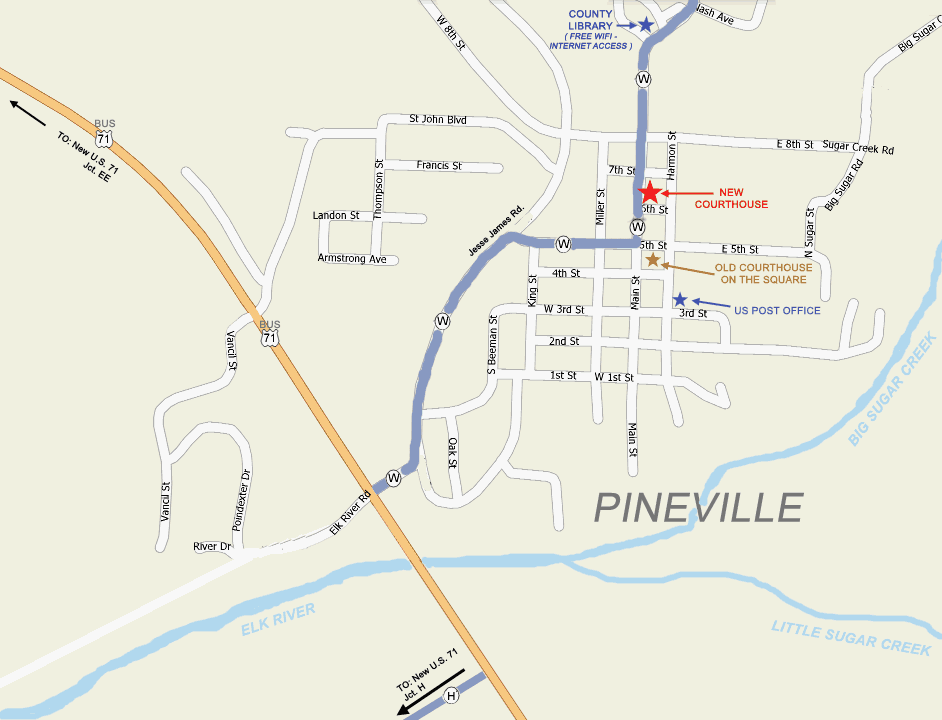
Pineville area street map (Showing courthouse locations, Library & P.O.)
Low-Resolution GIF (41k)
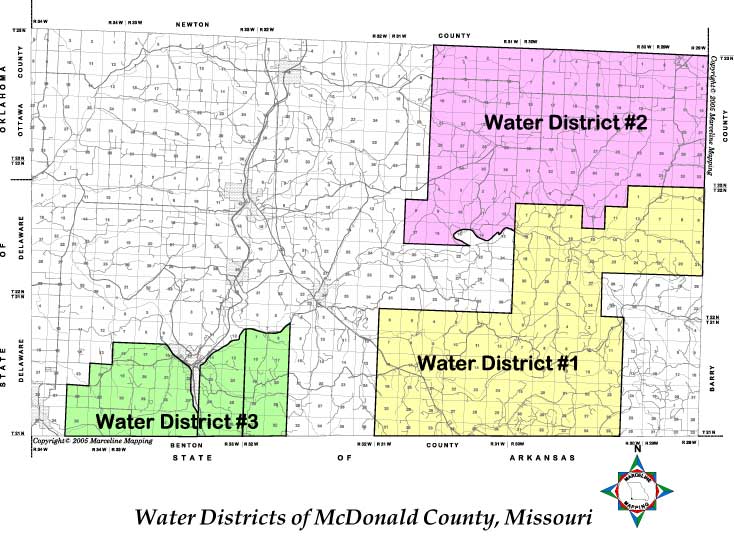
Water Districts
Low-Resolution JPEG ( 75k)
High-Resolution.PDF (819k)